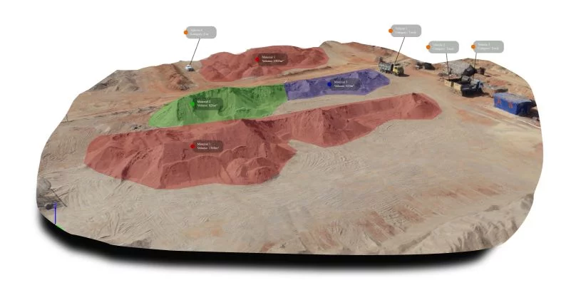
Drones in Asset Monitoring
Axesmap drones help in construction scheduling and costing, real-time recording, reporting, billing, verification & planning

Drones for Asset Monitoring
“Drones are one of the best ways to monitor the progress of a project. They provide the project manager with data to track workflow, manage resources, reduce downtime and keep projects on schedule and within budget” – GeoSpatial World
Our data helps you in
- Get video content with information on-site construction progress.
- Get date wise data, anytime, anywhere.
- Make sure that the construction site is effectively planned and safe
Improved safety
The project manager can have a complete look at the construction program, all in one window
Our construction monitoring service can significantly reduce the effort required in traditional construction monitoring and reporting procedures
Drone Survey & Mapping Services in Karnataka
Ready to elevate your project with precision aerial data? Contact Axesmap, your trusted partner for drone survey and mapping services in Bengaluru, Karnataka. Let's turn your vision into reality with the power of drones.
Don't miss the opportunity to experience the future of survey and mapping. Join the Axesmap family today!

Axesmap
Ejesmapa Technologies Pvt Ltd
Bengaluru 560056
+91 7337731363
hello@axesmap.com
Regional Office: MG Road,
Hassan 573201
